Quake Data | Interactive map | User Reports | Aftershocks | Earlier quakes in same area | Bari | Sanaag | Hadramaout | Shabwah | Aden | Woqooyi Galbeed | Togdheer
14 Jun 5:45 am (GMT +3) – 2 hours 4 minutes ago
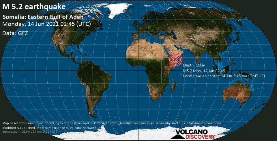
Strong magnitude 5.2 earthquake at 10 km depth
14 Jun 02:50 UTC: First to report: VolcanoDiscovery after 6 minutes.
14 Jun 02:53: Now using data updates from GFZ
14 Jun 02:53: Magnitude recalculated from 5.3 to 5.2. Epicenter location corrected by 3.1 km (1.9 mi) towards NW.
14 Jun 02:53: Now using data updates from GFZ
14 Jun 02:53: Magnitude recalculated from 5.3 to 5.2. Epicenter location corrected by 3.1 km (1.9 mi) towards NW.
Date & time: 14 Jun 2021 02:45:00 UTC – 2 hours 4 minutes ago
Local time at epicenter: 14 Jun 5:45 am (GMT +3)
Magnitude: 5.2
Depth: 10.0 km
Epicenter latitude / longitude: 12.66°N / 48.57°E (Golf von Aden, Somalia)
Nearest volcano: Harra of Bal Haf (102 km / 63 mi)
Nearby towns and cities:
167 km (104 mi) NNW of Bosaso (pop: 74,300) –> See nearby quakes!
172 km (107 mi) NNE of Las Khorey (Badhan) (pop: 6,940) –> See nearby quakes!
194 km (120 mi) NW of Qandala (pop: 15,900) –> See nearby quakes!
218 km (135 mi) SSW of Mukalla (Yemen) (pop: 258,100) –> See nearby quakes!
262 km (163 mi) NNE of Erigavo (pop: 33,900) –> See nearby quakes!
281 km (175 mi) SE of Ataq (Yemen) (pop: 37,300) –> See nearby quakes!
284 km (177 mi) WNW of Bereeda (Calawla) (pop: 11,300) –> See nearby quakes!
384 km (238 mi) E of Aden (Yemen) (pop: 550,600) –> See nearby quakes!
459 km (285 mi) ENE of Berbera (pop: 242,300) –> See nearby quakes!
481 km (299 mi) NE of Burao (pop: 99,300) –> See nearby quakes!
Local time at epicenter: 14 Jun 5:45 am (GMT +3)
Magnitude: 5.2
Depth: 10.0 km
Epicenter latitude / longitude: 12.66°N / 48.57°E
Nearest volcano: Harra of Bal Haf (102 km / 63 mi)
Nearby towns and cities:
167 km (104 mi) NNW of Bosaso (pop: 74,300) –> See nearby quakes!
172 km (107 mi) NNE of Las Khorey (Badhan) (pop: 6,940) –> See nearby quakes!
194 km (120 mi) NW of Qandala (pop: 15,900) –> See nearby quakes!
218 km (135 mi) SSW of Mukalla (Yemen) (pop: 258,100) –> See nearby quakes!
262 km (163 mi) NNE of Erigavo (pop: 33,900) –> See nearby quakes!
281 km (175 mi) SE of Ataq (Yemen) (pop: 37,300) –> See nearby quakes!
284 km (177 mi) WNW of Bereeda (Calawla) (pop: 11,300) –> See nearby quakes!
384 km (238 mi) E of Aden (Yemen) (pop: 550,600) –> See nearby quakes!
459 km (285 mi) ENE of Berbera (pop: 242,300) –> See nearby quakes!
481 km (299 mi) NE of Burao (pop: 99,300) –> See nearby quakes!
Weather at epicenter at time of quake:
Overcast Clouds 31.2°C (88 F), humidity: 68%, wind: 6 m/s (12 kts) from W
Overcast Clouds
31.2°C (88 F), humidity: 68%, wind: 6 m/s (12 kts) from WPrimary data source: GFZ (German Research Centre for Geosciences)
Estimated released energy: 4 x 10¹² joules (1.11 gigawatt hours, equivalent to 951 tons of TNT) More info
500 km
500 mi
Leaflet | Map data: © Google Maps
[smaller] [bigger]
If you felt this quake (or if you were near the epicenter), please share your experience and submit a short “I felt it” report! Other users would love to hear about it!
Also if you did NOT feel the quake although you were in the area, please report it! Your contribution is valuable also to earthquake science and earthquake hazard analysis and mitigation efforts. You can use your device location or the map to indicate where you were during the earthquake. Thank you!
Also if you did NOT feel the quake although you were in the area, please report it! Your contribution is valuable also to earthquake science and earthquake hazard analysis and mitigation efforts. You can use your device location or the map to indicate where you were during the earthquake. Thank you!